Description
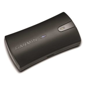
The aera 660 puts the latest Garmin technology in the palm of your hand. While the aera 660 is light, compact and fits in any flight bag, it is also packed with capabilities. As a dedicated navigator, it quickly and reliably acquires GPS and GLONASS satellite constellations and combines advanced navigation tools with rich, interactive, dynamically drawn aviation maps. it displays all this information on a bright sunlight-readable 5-inch diagonal touchscreen display.
The aera 660 GPS comes preloaded with detailed flight mapping, terrain and obstacles alerting, U.S., European and Canadian “Safe Taxi” charts and AOPA Airport Directory or optional AC-U-KWIK Global Airport Directory to put a wealth of resources right at your fingertips – including local fuel prices (U.S. Only) The graphical Terrain page offers both vertical and overhead profile views of the topography beneath you. Switch to IFR map mode to display and navigate on high or low en-route airways, and use your touchscreen map cursor to reference MEA’s (minimum en-route altitudes) and distances between intersections. The aera 660 even provides vertical navigation (VNAV) guidance to simplify en-route transitions.
You will stay aware of special airspace activity (parachute drop zones – U.S. Only) and get 1-touch airspace information. Garmin “Smart Airspace” guidance conveniently highlights the airspace nearest your current altitude and de-emphasizes non-pertinent airspace so you can quickly identify your location relative to the airspace around you. The aera 660 includes Garmin’s signature “direct to” and “nearest airport” navigation.
Using Bluetooth connectivity via Garmin “Connext” technology, the aera 660easily interfaces with compatible devices to cut the clutter in your cockpit and improve your flying experience. With a Garmin “GDL 52” portable ADS-B/SiriusXM receiver or “GTX 345” all-in-one ADS-B transponder, you can access and display ADS-B subscription-free weather (U.S. only) and advanced traffic alerts, including “Target Trend” relative motion tracking and “Terminal Traffic”, so you are aware of potential conflicts in busy terminal airspace. It even allows wireless control of Garmin “Virb” action cameras to start and stop recordings and capture photos.
Revolutionary 3-D Vision technology gives you a virtual 3-D behind-the-aircraft perspective view of the surrounding terrain derived from GPS/GLONASS and the onboard terrain database. Slide your finger across the touchscreen to rotate the view and show land and water features, obstacles, runways and airport signposts in relative proximity to the aircraft. Connect the aera 660 to an attitude source through a Flight Stream 210 or Flight Stream 510, a GDL 52 series portable data link or a GTX 345 ADS-B transponder and the Garmin SVX synthetic vision and attitude command bars are automatically added to your display. Plus, with its forward-looking terrain avoidance capability, the aera 660 predicts in advance where towers or obstacles may exist and shades the landscape with amber or red overlays to indicate those areas. Also, get help flying clear of conflicts with Garmin “Wire Aware” wire-strike avoidance technology., which graphically overlays Hazardous Obstacle Transmission (HOT) lines that span rivers and canyons right on the moving map page, for the U.S. as well as some locations in both Canada and Mexico. Touch the wire to display both MSL and AGL heights, and see colour-coded obstacle alerting depending on your distance to the hazard. An optional full database that includes all powerlines is also available.
Instead of connecting to a computer via a cord, you can update the aera 660database via WI-FI, and stay current throughout the year with a single, affordable annual subscription that includes all the databases you need, including the Garmin Navigation Database (U.S., Canada and Mexico versions only)
The aera 660 fulfills the role of either a Class I or Class II electronic flight bag, greatly reducing the need to rely on paper charts in the cockpit. U.S. geo-referenced VFR sectionals and IFR enroute charts come preloaded to show your aircraft’s position overlaid directly on the relevant chart. Optional European and Canadian VFR and IFR charts and airport diagrams are also available. When in IFR map mode, the aera 660 can display victor airways, jet routes, leg distance and more, similar to traditional enroute charts. Plus, pilots who prefer Jeppesen charts and diagrams can use the built-in “Chartview” capability, which uses Jeppesen’s extensive library to provide global geo-referenced charting capabilities.
With a long list of features, the Garmin aera 660 combines many of the capabilities of panel-mounted avionics with a single value packed, purpose-built package. It is a dedicated partner that’s “ready to fly…right out of the box”.
Specifications
Physical dimensions: 5.5″W x 3.4″H x .8″D (41.1 x 8.7 x 2.1 cm)
Display size: 5.08″ (12.9 cm) Diagonal
Display resolution: 480 x 800, portrait and landscape orientation
Display type: touchscreen WVGA colour TFT with white backlight
Weight: 8.64 oz. (245 grams) with battery; 7.23 oz. (205 G) without battery
Battery: removable, rechargeable lithium-ion
What’s in the box?
aera 600
Yoke Mount w/ Power Cable
Battery
AC Adapter
USB Cable
Quick Start Manual and Related Documentation